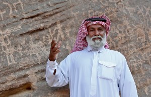
Hamad Shanoof al Alarjaa, At Bi’r Hima, Najran Province.
It must be obvious to the countless Bedouin pastoralists who have traversed the deserts of Arabia for millennia that it was their ancestors who paused long enough to record their stories in the rocks for future generations. When foreign, or even local, archaeologists applaud what appear to be “new discoveries,” it is comparable to Christopher Columbus taking credit for discovering the New World long after Paleoindians first entered North America. What is new to our eyes is often quite familiar to our guides, who have wandered past these mysterious scenes routinely through their lives. We therefore ask the indulgence of our Bedouin friends as we endeavor to understand the meanings behind the rock art and, as children, relish in the delight of “discovery,” even if it is original only in our own mind’s eye.
Some of the earliest observations of Saudi Arabian petroglyphs were made by Lady Anne Blunt and her husband Wilfrid Scawen Blunt. Lady Anne was the 15th Baroness Wentworth and granddaughter of Lord Byron. In her own right, she was an accomplished violinist, artist and equestrienne. Wilfrid was a distinguished poet and writer of essays about Middle Eastern politics. The Blunts traveled to the desert three times between 1877-1881 to acquire horses for breeding. Their Crabbet Stud, in England, and Sheykh Obeyd estate, near Cairo, produced some of the most influential Arabian horses. Today over 90% of all Arabian horses can trace their pedigrees back to Crabbet horses. One of the Blunt’s journeys in search of fine Arabian horse breeding stock began on December 6, 1878, in Damascus, headed south to Ha’il, and terminated in Baghdad on March 6, 1879, after they were forced to change their plans to avoid Riyadh. Before crossing the great sand sea of An Nafud, in northern Arabia, the Blunts spent some time in Al Jawf, on its northern edge. Moving on to the next settlement, Meskakeh, 15 miles away, they followed a well-traveled road. En route between Al Jawf and Meskakeh, Lady Anne recorded a petroglyph of camels and horses carved on a flat rock about 1.5 m in width. She regretted that they could not stop to make a drawing of it (Blunt 2002: 127). A bit farther in their journey, as she sketched striking sandstone formations, she came across images of gazelles and camels, as well as a few inscribed letters carved into the stone (Blunt 2002: 147-148). In 1884, Gaston Vuillier created a beautiful wood engraving of the pink sandstone cliffs in this area.
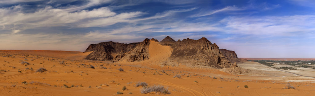
Jabal umm Sanaman, looking north. The town of Jubbah is on the right.
After exiting An Nafud, the Blunts paused briefly at the oasis of Jubbah, on the desert’s southern edge. Of adjacent Jabal umm Sanaman, which bears some of the most incredible Arabian petroglyphs, Lady Anne remarked:
“The rocks towering above are very grand, being of purple sandstone streaked and veined with yellow, and having an upper facing of black. They are from seven to eight hundred feet high, and their bases are scored with old watermarks. Sir Wilfrid found several inscriptions in the Sinaïtic character upon them.” (Blunt 2002:188).
Way station at Jubbah where Lady Anne and Wilfrid Scawen Blunt rested in 1879.
Following the same route as the Blunts from Damascus to Ha’il, in 1883-84, were the German epigrapher Julius Euting, and his Alsatian travelling companion, Charles Huber, also an Oriental epigrapher. Huber’s posthumously published diary (1891) includes many details about regional topography, archaeology and inscriptions. He produced illustrations of some of the inscriptions at Jubbah, but none of the rock art. Euting was a scholar of Oriental languages and traveled to Arabia to record pre-Islamic inscriptions and monuments. His accounts (Euting 1896, 1914) of their year-long Arabian journey provide the best early descriptions of the petroglyphs at Jabal umm Sanaman. In his diary, he wrote about the inscriptions and art he encountered:
“The strangest thing that I discovered was a Hebrew (No. 1), then a Nabataean (No. 2), a lot of early-Arab (for example, No. 3.), whose origination from the southern alphabet is not yet sufficiently [known], and finally a Kufic (No. 4). Between were a lot of camels, ibexes, war and hunting scenes. Very strange is the representation of a two-wheeled carriage with harnessed horses (No. 5). The artist, who provides an example like those seen far outside the confines of the Nagd, has alleviated the difficulties of perspective by a bold twist on two sides.” (Euting 1896: 152-153).
By this last statement, Euting was referring to the chariot petroglyph, which he illustrates, that is shown in aerial view with the two horses in recumbent style, as if lying back to back.
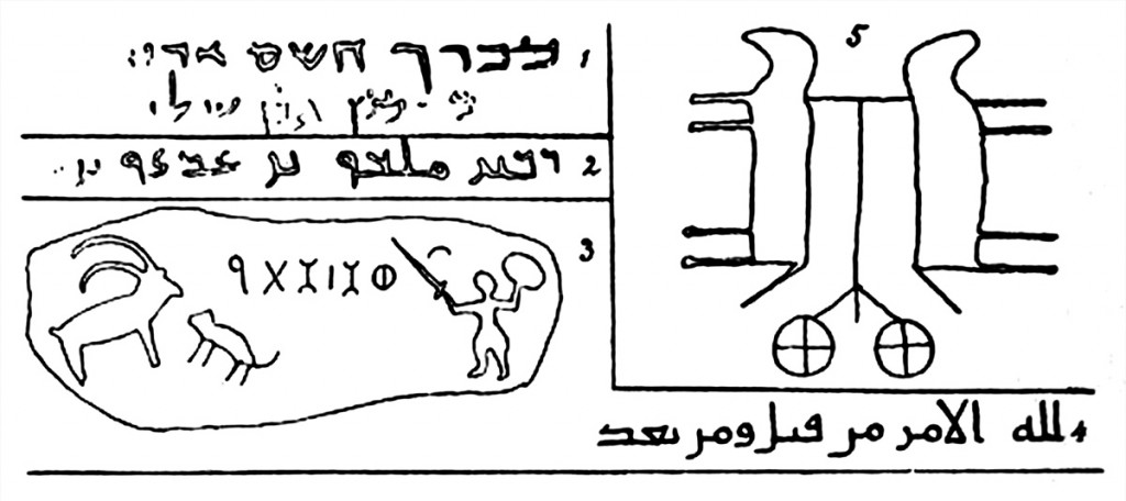
Illustrations of inscriptions and petroglyphs in Euting’s diary (1896: 152).
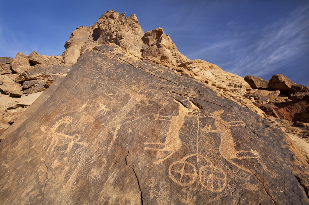
The petroglyph of a chariot pulled by two horses at Jubbah that Euting illustrated. Note that Euting did not indicate the damage to the head of the horse on the left or the rider added to the horse on the right by a later artist.
In the 1920’s and 30’s, George Horsfield (Horsfield et al. 1933) and his wife Agnes Conway Horsfield (1943) worked in what is today Jordan, excavating at Petra, the citadel in Amman, Jerash, and Wadi Rum. They focused mostly on Nabataean sites, but in 1932, while visiting the Christian monastery of Kilwa (1000 CE), they encountered petroglyphs. Kilwa was then in the Transjordan, but now lies within the borders of Saudi Arabia. They were accompanied by Nelson Glueck (1939), who described their discovery on a hillside just northeast of Kilwa. The surfaces of the hill were thoroughly packed with rock art, which they recorded photographically. Their collection of photos currently resides in the University of London Institute of Archaeology. One of the images in the Kilwa rock art that particularly caught their attention, the one they coined the “best ibex,” was a “wounded ibex with blood streaming from his mouth” (Horsfield et al. 1933:385). They were the first Westerners to report seeing the petroglyphs, although Gertrude Bell had been to Kilwa in 1914. It was left to Hans Rhotert (1938) and Leo Frobenius to follow up with a professional study in 1934-35.
Harry St. John Bridger Philby, born in 1885, was a colorful character in Saudi history. He was an Arabist and explorer, as well as a British military man, writer, businessman, and advisor to Ibn Saud. Traveling on camelback, Philby mapped the Saudi-Yemeni border and penetrated deep into the Rub’ al Khali. He was the first Western visitor, in 1932, to see the Wabar craters, a pair of depressions created by a large meteor shower.
In his travels, Philby encountered many examples of rock art, but scientific investigation was not to come until he teamed up with Professor Gonzague Ryckmans, of Catholic University of Louvain, Belgium, an expert in pre-Islamic Arabian epigraphy. Accompanying them on their expedition in 1951-52 were Philippe Lippens and Ryckmans’ son Jacques (Anati 1968a). The journey began in Jeddah and ended in Riyadh, passing en route through Makkah, Taif, Abha, Najran, Qarya, Wadi Dawasir, and Masil. Most of the petroglyphs they discovered were in the Jabal al Qara valley, northeast of the modern city of Najran. Their project recorded about 200 petroglyphs, which were documented in some 230 photographs.
In 1961, M. Emmanuel Anati, a leading authority on Near Eastern and European rock art, turned his attention to the collection of photographs from the Philby-Ryckmans-Lippens expedition. His earlier coverage of the petroglyphs of the Negev is still some of the most important work in the region (Anati 1955a, b, c; 1956; 1963; 1967). Anati, who did not actually travel in Saudi Arabia himself, nonetheless made a major contribution in publishing the expedition photographs along with his analysis of the petroglyphs. The resulting four volume series (Anati 1968a, b, 1972, 1974) provides written descriptions and illustrations to accompany the photographic images. Anati’s extensive knowledge of petroglyphs in Anatolia, Syria-Palestine, Mesopotamia, and Egypt enabled him to compare images in those areas with the ones recorded in Philby and Ryckmans’ expedition in southwestern Saudi Arabia. He established a chronology for the Najran region, subdividing the major time periods into smaller subunits based on variation in style, figure size, subject matter, and type of associated script, if present. However, Khan (1998) has pointed out inconsistencies and problems with the dates that he assigned.
In 1962, shortly after Anati began interpreting the photographs from Philby and Ryckmans’ expedition in the south, Frederick V. Winnett and William L. Reed (1970) spent a month traveling around northern Saudi Arabia conducting an archaeological and epigraphic survey. At an outcrop known as Al Qal’ah, four miles from Sakakah, they recorded seven images of ostriches, along with Thamudic and Nabataean inscriptions. West of the qasr at Sakakah, a small sandstone hill called Burnus bore shallow engravings of 13 or so female figures wearing flat-topped hats with fringe along with some indeterminate animals. Perhaps because the arms of the women are bent at the elbow and their hands are up in the air, Winnett and Reed referred to them as the “dancing girls.” They noted, however, that the scene equally could depict praying. A lion was identified along with Thamudic inscriptions just five km from the oasis of Al Jawf. At Ghar al Hamam, 3 km northeast of Tayma, they found figures of ibexes and domestic cattle alongside Thamudic inscriptions. At the summit of Jabal Ghunaym, 14 km southeast of Tayma, they flipped over a stone slab to reveal a petroglyph of a human female, which they interpreted as a goddess. On their descent, they located three triangular heads with pairs of horns that had been reported earlier by Philby (1957). These are associated with a crescent moon and stars and may represent aspects of the god Salm.
Between 1976-81, the Comprehensive Survey of Saudi Arabia undertook a vast archaeological investigation of the Kingdom (Adams et al. 1977 and Parr et al. 1978). During the survey numerous petroglyph localities were discovered and revisited for more detailed analysis. Jubbah was one of the localities from the survey that was described and illustrated (Parr, et al. 1978).
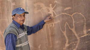
Dr. Majeed Khan at Hafrat Berd, near Tayma.
Our colleague and team member, Majeed Khan (1991, 1993, 1998, 2000, 2003, 2010), has spent more than 30 years exploring various regions of Saudi Arabia, documenting hundreds of sites. No other living person has seen as many rock art localities in Saudi Arabia as Dr. Khan or published as much on the topic. Through the years, he has generously shared his knowledge with others, including ourselves, enabling his colleagues to better understand how rock art in Saudi Arabia fits into the bigger picture of the region and beyond. Most recently, he investigated the distribution of equine images, including both onagers and horses (Khan 2012).
Although the Negev has thousands of examples of rock art, little research had been conducted since that of Emmanuel Anati in the 1950’s until Davida Eisenberg-Degen recently performed a large-scale investigation. She found depictions of extinct hartebeests, as well as ibexes, camels, and cattle. Scenes include humans hunting and trapping, engaging in warfare, and worshipping. Har Karkom, which is situated between Sinai and Negev and possesses 40,000 engravings, is a nexus for rock art in the region.
While northern Syria has only a few known petroglyph localities, figures and inscriptions are abundant in the south at Hisma and in the basaltic harra (Betts 2001, Betts and Helms 1987). Long-horned cattle, perhaps cattle, as well as many other figures, have been reported in close proximity to the archaeological site of Jawa (late 4th millennium BCE) on the Jabal Druze (Betts 2001).
In Jordan, the best-known examples of rock art are still to be found in Wadi Rum, in the southernmost part of the country, 60 km east of Aqaba. In 2011, the 74,000-hectare Wadi Rum Protected Area was declared a UNESCO World Heritage site. There are at least 25,000 images carved in the rock, as well as 20,000 inscriptions. The steep-sided, narrow Khaz’ali Canyon is one of the prominent localities for rock art, but smaller boulders elsewhere also frequently served as canvases for the artists. The petroglyphs in Wadi Rum, most of which apparently date to the first millennium BCE, consist of humans (especially cavalry and infantry), camels, ostriches and other desert animals. Inscriptions written in ancient Arabic (Thamudic and other related scripts) and Nabataean are quite common. (Macdonald and Searight 1982; Searight 1983, Searight Macdonald 1982).
Yemen and Oman have also yielded some rock art, most of which appears to be from relatively late periods (Parr et al. 1978). In Yemen, petroglyphs have been reported between the mountains and desert in the northeast and in a series of wadis in the south (Jung 1991, 1994; Garcia and Rachad 1997). In northern Oman, petroglyphs have been studied at Jabal Akhdar (the “Green Mountain”), which is in the Al Hajar mountain range (Clarke 1975 a, b), as well as in the south in the Dhofar Governate, near the eastern border of Yemen. Bertram Thomas (1932) first reported the existence of rock art in Oman in 1931, when he described the sites of Wadi Ghaf and Khatma Milah. The U.A.E. has produced modest examples of rock art that are not particularly varied (de Cardi and Doe 1971; Jongbloed 1994; Ziolkowski 1998, 2007).